Integrated Projects
Autonomous Aerial Collision Avoidance System (AACAS)
I worked on the AACAS system as part of my final project in the Master's of Robotic Systems Development (MRSD) program at Carnegie Mellon University. Here is the project website as a reference. The three semester project spent the first month on systems engineering and project management planning, and the final two semesters on development.
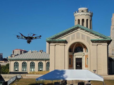
The project focused on the desire to enable beyond visual line of sight (BVLOS) flying for drones. A hurdle in enabling BVLOS flight is handling collision scenarios with other aerial objects. In a team of four, I developed a proof of concept solution comprised of a DJI M600 drone, a 3D lidar, and an RGB camera.Our system searches for nearby obstacles while performing a waypoint following flight path. The camera searches for the obstacles using a custom trained YOLO network. After an obstacle is located by a bounding box, the depth is found using the lidar points corresponding to the bounding box. The drone then takes evasive action if the flight path intersects with the obstacle's predicted path.
My work on the project focused on simulation, path planning, and control. I implemented a potential field approach as the preliminary reactive planner. This approach used the optimal velocity, drone velocity, and the predicted obstacle trajectory to orbit around obstacles en route to the goal.
To test and refine the planning I developed a simulation environment in ROS using RVIZ. I developed the environment to seamlessly integrate with, simulation tools provided by DJI. I also extended the functionality of the DJI simulator by implementing custom obstacle dynamics and visualizations. This image shows the mid-project validation results. The drone avoids a stationary ball using noisy sensor data. Shortly after these results I demonstrated the avoidance of moving objects and multiple stationary objects.


Click the image for the final demonstration video of the system.
One of the greatest lessons I learned during this project is the importance of proper systems engineering and planning. After three months of development, the COVID outbreak in 2020 forced the team to work remotely and cancel all hands-on development. Having done the initial planning, we identified the work packages that could be accomplished at home and rescoped the project goals accordingly. Our adaptations resulted in positive feedback from both our professors and sponsor.
Safety Analysis and Extension
After the AACAS project concluded, I had the pleasure of taking the Provably Safe Robotics course from Dr. Changliu Liu. I chose to do the final project on a safety analysis of the planning and controls of the AACAS system. I approached analyzed the problem with an adversarial game between an evader running the AACAS planner and a pursuer, who attempted to crash into the evader.
This study helped me learn carefully planned systems can have glaring problems when viewed from a different perspective. I was fortunate to see the importance of analyzing safety and failure points throughout a robotic pipeline. Dr. Liu was so impressed with my work she asked I make it public as reference to future course websites. You can view the source code and report at this repository.
The following videos show the original AACAS system (left) and the improved system (right). In these videos the safety agent (orange dot) is attempting to reach the goal (green dot). The adversary (red dot) begins at the goal pointed towards the evader. The red circle shows the avoidance radius where the robot begins to avoid. The blue circle is the failure limit, where a crash is deemed to occur.


Mobile Active Threat Emergency System (MATES)
The MATES project was developed as a submission to the Air Force Research Lab's University Design Competition in 2019. I competed in the competition for my Mechanical Engineering senior design project at Utah State University. In rapidly developing emergencies, such as active shooters, natural disasters, or building collapses, the largest loss of life occurs due to miscommunication between first responders. After interviewing EMTs, police officers, enlisted military, and emergency response managers I implemented a proof of concept solution to better enable emergency response. My team developed an Internet of Things (IoT) application, with ThingWorx, that connects all first responders with one another in real time.
Our proof of concept application connected three types of emergency responders: leadership, armed, and medical. Each group received a web-based app customized for their duties during an experiment. We designed the system to optimize the appropriate amount of data sharing between the responders in an easy to digest delivery. I worked on the entire IoT platform, which included the GUI design, data sharing, and edge device integration. You can read further details of the project in the following report and presentation.
This video shows a beta demonstration of the system several weeks before the competition. It goes through each of the GUIs detailed below and does a small demonstration of the armed responder. Several improvements occurred between this video and the presentation. They include streaming the video instead of sending screen shots at 1 fps. The other main improvement fixed the flashing and reset errors on the leadership screen when the data refreshes.
Emergency Response Leadership (Central Command)
Emergency leadership attempts to direct response efforts and resources during emergencies. Their biggest difficulty is understanding the nature and extent of a dynamic emergency despite misinformation and information overload. To enable their response, I developed a GUI that shows leadership a map of the emergency area with pins representing responders and victims. It also allows leadership to update victim counts as the situation evolves, view the personal information of the responders on scene, view live body camera footage, and broadcast it to the team.


Medical Responders
The medical first responders survey the emergency area to locate and number the victims. When they find a victim, they detail the triage count of the victims in the area and an optional description. The app then creates a pin at the GPS coordinates of the responder and updates the emergency map to central command. This easy to use system was designed to quickly update data and help central command send medical responders to high victim areas.


Armed Responders
For active threat emergencies, such as an armed threat, armed responders search the scene to eliminate the threat. Accordingly, their app requires no data entry and only shows information. We discussed this screen in detail with a Corporal in the Marine Corps, a SWAT instructor, and a Chief of Police. With their feedback, I developed a GUI that shows a map of the area on one side, and a video stream on the other.
The operator can select the desired stream from one of four sources: body camera, thermal camera, bore scope, and team stream. The body camera stream enables operators to place their body camera in hallways or around corners to watch the area remotely, or without exposing themselves to danger. The thermal camera enables responders to find heat signatures and locate hidden threats or victims. The bore scope is a camera on the end of a wire that enables the responders to view under doorways or around corners before exposing themselves to danger. The final stream, team stream, comes from leadership and shows one of the camera feeds from another operator. It would be useful to identify a shooter or other item of interest.
